About Central America Topo Maps
Easy to use outdoor and navigation app with 1:50.000 topographic maps of Guatemala, Honduras, El Salvador and Nicaragua. This app gives you similar mapping options as you might know from Garmin or Magellan GPS handhelds....
Easy to use outdoor and navigation app with 1:50.000 topographic maps of Guatemala, Honduras, El Salvador and Nicaragua.
This app gives you similar mapping options as you might know from Garmin or Magellan GPS handhelds.
Main features for outdoor-navigation:
• Create and edit Waypoints
• GoTo-Waypoint-Navigation
• Create and edit Routes
• Route-Navigation (Point-to-Point Navigation) (NOT in this free version !)
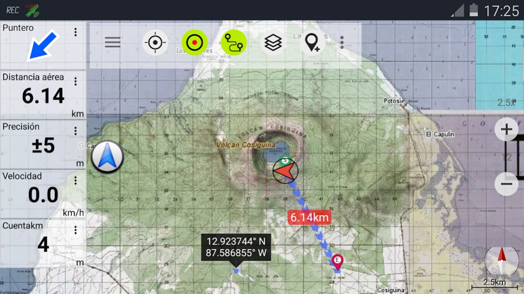
• Track Recording (with speed, elevation and accuracy profile)
• Tripmaster with fields for odometer, average speed, bearing, elevation, etc.
• GPX-Import / Export, KML-Export (NOT in this free version !)
• Search (placenames, POIs, streets)
• Customizable datafields in Map View and Tripmaster (e.g. Speed, Distance, Compass, ...)
• Share Waypoints, Tracks or Routes (via eMail, Facebook, ..)
• and many more ...
Available map layers:
• Topo maps 1:50.000 and 1:250.000 with seamless coverage for Guatemala, Honduras, El Salvador and Nicaragua. Belize, Costa Rica and Panama are covered with 1:250.000 topo maps.
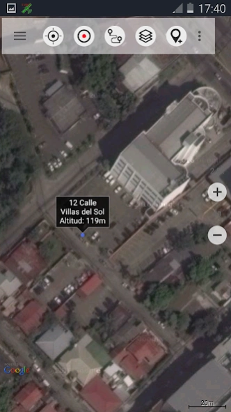
• Google Maps (Satellite images, Road- and Terrain-Map)
• Bing Maps (Satellite images, Road-Map)
• Open Street Maps (OSM Mapnik and Cloudemade Cyclemap)
• Hillshading overlay layer for OSM, Google or Bing maps
LIMITATIONS OF THIS FREE VERSION:
• Ads
• No Bulkdownload of maps for offline usage
• No Hillshading overlay
• Max. 3 Waypoints
• Max. 3 Tracks
• No Routes
• No import of waypoints and tracks
• No Bulkdownload
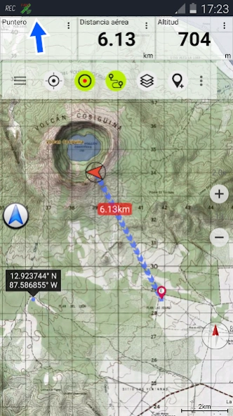
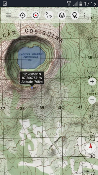
On the 1:50.000 maps you'll find many small roads, pathes and 4WD tracks that are not included in Google, Bing or OpenStreetMaps. The topo maps have a very detailed topography with contour lines. There is no other online mapping service/app available that gives you more detailed geographic features like rivers, lakes, hills, vegetation, villages, etc. for this region.
The topo maps layer is a seamless mosaic of more than 1000 georeferenced maps. Although some of the maps are quite old (production range of the maps is 1955 - 2006) they are still very good for outdoor trips, especially if you are looking adventurous routes or abandoned places. Most maps of Guatemala are quite up to date (mostly created in the 90ies) while maps of eastern Nicaragua were created in the 60ies/79ies. Within the app you can open an overview map with the publishing dates of the maps.
In larger cities you'll find it more usefull to switch to Google or OSM maps but in the backcountry you will recognize the relevance of large scale topographic maps.
The 1:250.000 maps are JOGs (Joint Operations Graphic) which represent a medium scale map intended as both a topographic and an aeronautical chart.
Use this navigation app for outdoor activities like hiking, biking, camping, climbing, riding, canoeing or offroad 4WD tours.
Preload FREE map data for areas without cell service.
The topographic maps are enhanced with Atlogis® hillshading and placenames.
Original publisher of the 1:50.000 topo maps : United States NGA (National Geospatial-Intelligence), NIMA (National Imagery and Mapping Agency), DMA (Defense Mapping Agency)
Original publisher of the 1:250.000 topo maps: US NGA/NIMA JOG (Joint Operations Graphics)
Please send comments and feature requests to
[email protected]
Previous Versions
Here you can find the changelog of Central America Topo Maps since it was posted on our website on 2014-06-13 12:03:40.
The latest version is 7.2.2 and it was updated on 2024-04-01 15:57:11. See below the changes in each version.
Central America Topo Maps version 7.2.2
Updated At: 2024-03-10
Changes: ・Improvements & Fixes
Central America Topo Maps version 7.2.0
Updated At: 2024-01-11
Changes: ・Configure Waypoints to automatically stop track recordings
・10 waypoints, 5 tracks with free version
・Improvements & Fixes
Central America Topo Maps version 7.1.1
Updated At: 2023-11-17
Changes: ・More precise measurements
・App shortcuts
・Android 14 support
・Fixes
Central America Topo Maps version 7.0.4
Updated At: 2023-08-18
Changes: ・Added keyboard shortcuts to control the app with external keyboards or control devices like BarButtons
・Fixes
Central America Topo Maps version 6.7.1
Updated At: 2021-11-24
Central America Topo Maps version 6.0.3
Updated At: 2020-06-03
Changes: . Support for MBTiles / Mapsforge vector maps
. Improvements & Fixes
Central America Topo Maps version 6.0.0
Updated At: 2020-04-30
Changes: . Fixes
Central America Topo Maps version 2.6.2
Updated At: 2019-07-22
Changes: . Track recordings can be paused
. Support for track segments
. Improvements & Fixes
Central America Topo Maps version 1.1.1
Updated At: 2013-05-29
Changes: Several fixes and updates
Disclaimer
Official Google Play Link
We do not host Central America Topo Maps on our servers. We did not scan it for viruses, adware, spyware or other type of malware. This app is hosted by Google and passed their terms and conditions to be listed there. We recommend caution when installing it.
The Google Play link for Central America Topo Maps is provided to you by apps112.com without any warranties, representations or guarantees of any kind, so access it at your own risk.
If you have questions regarding this particular app contact the publisher directly. For questions about the functionalities of apps112.com contact us.